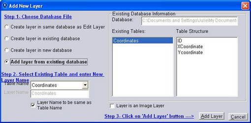
Create a new Layer (File New Layer) and select Add Layer from Existing Database. Select the required Table and Add Layer.
(Alternatively, click on File, Import and choose the Import Wizard, OK)
.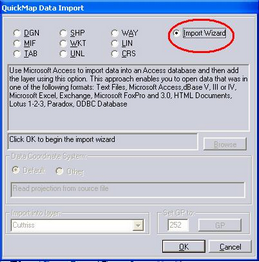
Select the Database and OK
This will bring up the Add New Layer dialog box with the option Add Layer from Existing Database as per Step 1 above.
From the Dialog box below, select XY - Point records defined by a single X and Y coordinate
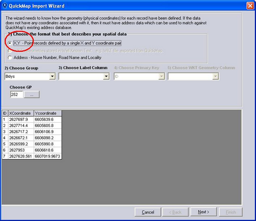
Choose the Group the layer is to be created in, the field representing the label and let QuickMap create a new Primary Key. Select Next
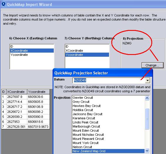
Select the X and Y Easting fields, change the projection if required and click on Finish.